
Typical Trekking routes on the way to Manimahesh Yatra in Himlayas (Pir Panjal Mountain ranges) : Part-2
Continuing the PHOTO JOURNEY through various treks to Manimahesh, here are few more photographs on the way to Manimahesh Pilgrimage Yatra in Chamba District of Himachal Pradesh...
Check out Part-1 if you have missed it
Check out Part-1 if you have missed it
Now clouds have starting chasing us and it can be a bad sign for such treks... Since trees will not be there on these heights, there will be no space to escape if rains start... If there is no rain, journey becomes wonderful with these clouds... because you will never know how much you have to cover next :-)

Some of us had some tents so we were comparitively safe if rain would have started... Here is a again a view of valley in the bottom of two hills with tents... Many of the pilgrims were looking back after some time... clouds were becoming more dense as we moved ahead...

Other worry was the path... since it was soil and stones... after rains it becomes risky to walk over them... If you are first time trekkking on hills, its important to have nice shoes with appropriate grip and have to have pateince to walk on the a balanced pace to avoid any mishappening... Don't worry, I was getting more sensitive about it.. Plan better and its very easy :-)

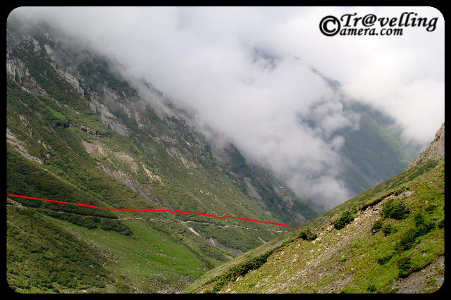
Here is an amazing this... See this path started form hill on right side and moved towards the another hill on left which is just opposite to the first one... But everyone had to cross through the same route, because the riverlets you see in the middle had very fast current... which is not very clear in this photographs.. but if you compare the size of tents and width of this strea, you would be able to estimate it... This whole path from one hill to another was around 4-6 kms....

Here comes the next level of tis trek with more rocky hills around and less grass.. Indicating that oxygen level is going down now.... Check out the photograph above and try to find out the path we followed..

Similarly, in this photograph its not very easy to locate the path...

One is short cut and other one is long but smooth...

Imagine yourself on this trek and huge moutains around... Can you see a large group of pilgrims on the turn?? Imagine the size of these hills... I can't explain...
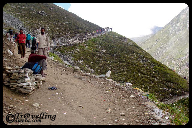
Pilgrims taking rest on the way to Manimahesh Lake in Bharmour region of Chamba District in Himachal Pradesh...

People who can't walk upto the hills and don't want to ride in Helicopter have another option... Horse Riding @ Mani Mahesh, Chamba, Himachal Pradesh, INDIA
CHECK OUT MORE PHOTOGRAPHS OF MANIMAHESH PILGRIMAGE TREK BY CLICKING LINKS BELOW :


.jpg)